

geography and climate
Smiling Brute
where is this place?
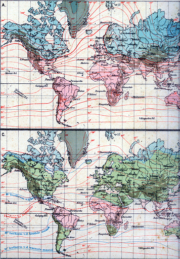
There are so many films and books beginning with a map where they zoom in on Curaçao, it has taken the keen edge off my taste for this gimmick. But if you look at a globe with a diameter of about 25cm you'll be amazed to find it there, just North of the Venezuelan coast. And to scale too; this for an island of a mere 60kms length. Shows you what a small world this is, if I may coin an expression, to coin another one.
Bos-Niermeyers Atlas der Geheele Aarde
Groningen, den Haag, Batavia 1932
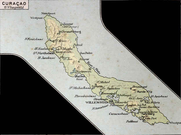
island maps
The best way to explore before you get here (and after you arrived) is to visit Google Earth.

When you come here, never pay for a map! They are distributed for free, but some hotels are so hard up they will charge you for them. The above will serve to give you a quick idea. The ones we like best of course are the Werbata Maps on which we based our 3D simulations, and which we sell on CD-ROM. You can also buy them in Curaçao bookshops. They are almost a century old, but if you like to do a bit of exploring beyond the beaten paths, they remain unsurpassed. (Don't forget your laptop.)
geology
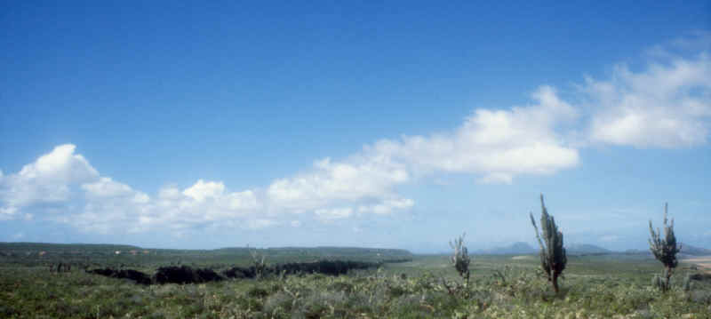
Vegetation is of the desert type, but often much more densely growing than you might expect. Since the population of Curaçao has grown to a density that about equals that of Holland or Japan, there is not that much extensive goat keeping any more; the island is much greener now than a century ago.
Part of map in
Bos-Niermeyers Atlas der Geheele Aarde
Groningen, den Haag, Batavia 1932
climate
It may be the global warm-up that's bothering us now, but it has always been awfully hot here in especially September and October. Count on 32º, but last week I measured 34.6º with a heat index of 43º. Unless you plan to spend your vacation under water, better pick another time. The sea is 26.3º averagely, minimum 25.4º in February. Evenings and nights are luxuriously wonderful.
It may be not the heat but the humidity you mind. Well, that's pretty heavy as well; the average relative humidity is over 80%.

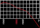
daily humidity curve
The one thing that makes life bearable and the climate very agreeable, mostly, is the Trade Wind, almost constantly blowing from the East at an average of 7.2m/sec. Sometimes, like yesterday - pfft! it doesn't. When the wind changes, you're probably in for rain; always welcome. Although we have some 575mms of rain per year, which is as much as the East of England gets, high temperatures and much wind take care for the climate's semi-desert character. We're happy when it rains: most falls in the tourist season, heh heh, from November to January.
Rainfall varies between 300 and 1200mms a year. Our thunderstorms are incredibly marvelous.
We're due for a hurricane every century or so; most pass by far to the North.
The last one to really hit us was in 1877.
I never saw snow, hail, sleet or ice before I first went to Holland, and the same goes for fog.
An anthropologist, Father Brenneker, tells how he was hiking with a couple of youngsters who amazed him by always knowing where North was, without a compass. He didn't know yet about the steady wind. Here, directions are not given in left or right, but "pabao", downwind or "pariba", upwind.
 |
 |
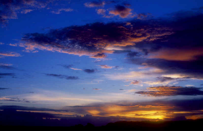 |
There are almost always clouds, resulting in what is called "photographic daylight" with exactly the right contrast values. Not only that; as they keep moving the light keeps changing and bringing out other details. After my Dutch painting sister-in-common-law Ria Rettich had been here, all of a sudden clouds started showing up in her paintings. And those Lower Lands clouds already are in a class of their own.
photographers
 |
 |
 |
| politics | tourism | economy |

Curaçao Island live in real time
SEARCH this site or the Web

 copyright notice
all material on this site, except where noted
copyright © by , curaçao
reproduction in any form for any purpose is prohibited
without prior consent in writing